Part 107 Exam Guide: Reading Sectional Charts & METARs Without Prior Aviation Experience
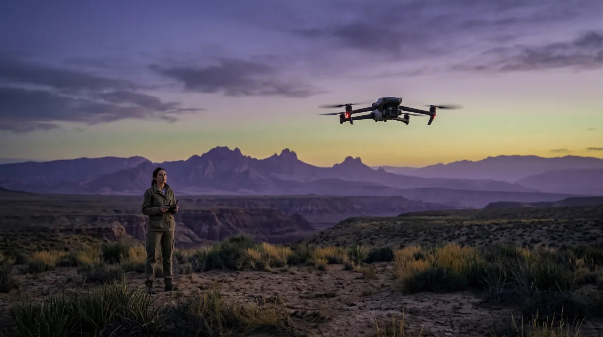
You do not need to be a pilot to pass this
The Remote Pilot certificate is a written test only: 60 questions, 70 percent to pass, and no flight check. Most people taking it have never touched an airplane, so the airspace and weather questions read like another language on day one. That feeling is normal, and it goes away fast.
Two topics make up the bulk of the test. Airspace and chart reading are roughly a third of it, and weather is another big slice. Nail those two in plain English and the rest, the rules and operating limits, is ordinary memory work. This guide translates the two hard parts.
Airspace is really one question: do I need permission?
Airspace is stacked in layers, sorted by letter. For a drone, each layer answers one practical question: do you need permission before you launch here? You are limited to 400 feet above the ground, so the jets overhead are almost never your concern. What matters is the airspace touching the ground where you take off.
The five classes, and which ones need a yes first
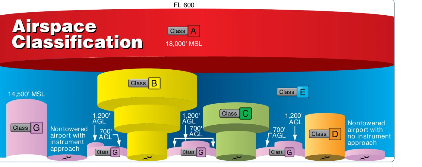
- Class B wraps the busiest airports and reaches to about 10,000 feet. Get authorization.
- Class C has an inner core (surface to 4,000 ft AGL) that needs authorization, plus an outer shelf (usually 1,200 to 4,000 ft AGL). Under that shelf, at 0 to 400 ft AGL, you are in Class G and need none.
- Class D is a single layer to about 2,500 feet above its airport. Get authorization.
- Class E is controlled, but you only need permission where it comes down to the surface for an airport.
- Class G is uncontrolled. No permission needed, though every other Part 107 rule still applies.
Class E, and the trap floors
Class E is where the exam sets its cleverest airspace questions, because its floor changes and the chart color tells you where. Read the magenta and blue like this:
- Dashed magenta line: Class E to the surface for an airport. This one needs authorization, exactly like B, C, and D.
- Faded magenta vignette (feathering): Class E floor at 700 ft AGL. Below it, from the surface to 699 ft, is Class G, so a drone under 400 ft AGL needs no authorization.
- Faded blue vignette: Class E floor at 1,200 ft AGL. Everything under it is Class G, so again, no authorization for you.
MSL vs AGL, the one conversion beginners miss
MSL is height above sea level, the number an altimeter shows. AGL is height above the ground right under you. Your 400-foot limit is AGL. Charted airspace ceilings are usually MSL. To go from one to the other, add the ground elevation.
How you actually get that permission
When the airspace at your launch site is controlled (B, C, D, or surface E for an airport), you need FAA authorization first. The Low Altitude Authorization and Notification Capability, LAANC, grants many of these in seconds through an approved app. In uncontrolled Class G, you need nothing.
- Read the sectional to identify the airspace at the surface, using the class rings and the airport data.
- If it is controlled, request authorization (LAANC or the FAA DroneZone) up to the published grid ceiling.
- If it is Class G, confirm nothing else applies, such as a temporary flight restriction or a national security area, and go.
Reading a METAR without memorizing a codebook
A METAR is a coded weather snapshot. The test hands you the raw string and asks for one value: visibility, wind, cloud height. The trick is that the groups always come in the same order, so you are never decoding the whole thing, just counting to the group you need.
| Group | What it means |
|---|---|
| KJFK | Station: the ICAO identifier |
| 121853Z | Date and time: the 12th at 18:53 UTC (Zulu) |
| 18009KT | Wind: from 180 degrees true at 9 knots |
| 10SM | Visibility: 10 statute miles |
| FEW250 | Sky: few clouds at 25,000 ft AGL |
| 28/19 | Temperature 28 C, dewpoint 19 C |
| A2992 | Altimeter: 29.92 inches of mercury |
Sectional symbols worth memorizing
A handful of symbols carry most of the chart questions, and the wrong answers are built from the ones that look similar. Learn what each color and shape actually means:
- Airspace class lines. Solid blue is Class B, solid magenta is Class C, dashed blue is Class D, dashed magenta is Class E to the surface, and the faded magenta or blue vignettes are Class E starting at 700 or 1,200 ft AGL.
- Special use airspace. Blue hatched borders, with the comb teeth facing inward, mark Prohibited (for example P-56), Restricted (R-2508), Warning (W-), and Alert (A-) areas. Magenta hatched borders mark Military Operations Areas (MOAs).
- Visual checkpoints. A magenta flag marks a VFR reporting checkpoint, so expect crewed aircraft to be congregating or descending there.
- Airport beacons. A star on top of an airport symbol means a rotating beacon that runs from sunset to sunrise.
- Airport data blocks. These list field elevation, the longest runway length, and the frequencies you will need when you request authorization.
A study order for a total beginner
Do airspace and weather first, because together they are most of the test and everything else is easier once you can read a chart. Once a sectional and a METAR make sense to you, the regulations and operations questions are straightforward. The Remote Pilot Part 107 Practice Test uses real FAA sectional excerpts and weather figures, and every answer explains the symbol or the rule, so you learn to read the chart instead of memorizing which letter goes with which question.